Semantic Seafloor Mapping
Doctoral Researcher:
Benson Mbani, GEOMAR - Helmholtz Centre for Ocean Research Kiel, bmbani@geomar.de
Supervisors:
- Prof. Dr.-Ing. Reinhard Koch, Kiel University, Multimedia Information Processing, rk@informatik.uni-kiel.de
- Prof. Dr. Jens Greinert & Dr. Timm Schoening, GEOMAR - Helmholtz Centre for Ocean Research Kiel, Marine Geosystems, jgreinert@geomar.de, tschoening@geomar.de
Location: Kiel
Disciplines: Computer Science, computer vision, pattern recognition
Keywords: image analysis, machine learning, spatio-temporal marine image processing

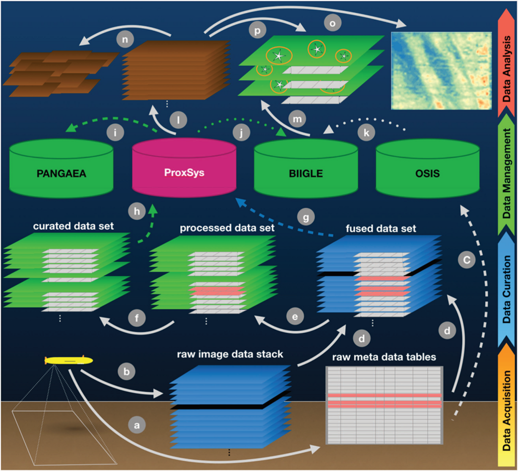
Motivation: Large collections of optical seafloor imagery are being collected by a multitude of diving robots and other camera platforms. The size of these big data sets ranges in the Terabyte scale and is expected to rapidly grow in the near future with the increasing availability of 4K video cameras and the upcoming Virtual Reality capabilities that are expected to make an impact to industrial and scientific marine operations. Extracting quantitative information requires semantic image analysis to extract characteristics of a variety of objects of interest (e.g. mineral resource abundances species distribution patterns). Analysis of Tera-byte scale data sets also calls for automated methods like machine learning and massive-parallel data processing as manual interpretation is infeasible.
Aim: Semantic information will be extracted from large collections of spatial and temporal underwater image sequences. Generic classification of geological (substrate, resources) (Schoening et al., 2017), biological (fauna, carrion) (Schoening et al., 2012) and anthropogenic (litter) (Schoening et al., 2015) objects will be targeted by unsupervised clustering and semi-supervised machine learning techniques. Contrast-enhancing methods will be implemented by pixel- and object-based algorithms. 3D morphology of multi-faceted objects (coral reefs, hydrothermal vents), will contribute further features to the detection and classification of objects of interest. Within this Doctoral research project, existing solutions to the automation challenge, which are tuned for one specific use-case, will be advanced towards generic marine image data analysis. This constitutes not only advancement for the natural science interpretation of marine imagery but also advances in the discipline of computer science.
Objectives: (1) Develop a generic workflow and related software for the classification of geological, biological and anthropogenic information from images, (2) develop algorithms for the automated analysis, segmentation and classification of big marine image data sets, (3) explore the usefulness of adding 3D information to the classification process, (4) learn with natural scientists what their needs are and tailor the developed application accordingly.
References:
- Schoening, Timm, Daniel OB Jones, and Jens Greinert. "Compact-morphology-based polymetallic nodule delineation." Scientific reports 7.1 (2017): 13338.
- Schoening, Timm, et al. "Semi-automated image analysis for the assessment of megafaunal densities at the Arctic deep-sea observatory HAUSGARTEN." PloS one 7.6 (2012): e38179.
- Schoening, Timm, et al. "DELPHI—fast and adaptive computational laser point detection and visual footprint quantification for arbitrary underwater image collections." Frontiers in Marine Science 2 (2015): 20.


